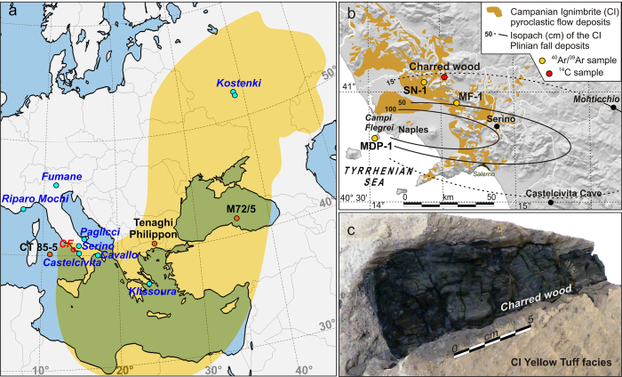
Figure 1. Reference maps and aspect of the charred tree branch embedded in the Campanian Ignimbrite (CI) yellow tuff facies.
(a) Location of the main palaeoenvironmental records (orange dots) and Palaeolithic sites (blue dots) mentioned in the text. The yellow shaded area is the dispersal areal of the CI tephra within the 0.5 cm isopach of the simulated ash fallout model3. CF: Campi Flegrei. (b) Geological sketch of the Campanian Ignimbrite (CI) pyroclastic deposits and isopach map of the CI Plinian fall (from ref. 3, 6 and references therein) with the location of the analysed samples of CI deposit for 40Ar/39Ar (orange dots) and of the 14C dated charred tree branch (red dot) embedded in CI pyroclastic showed in panel (c) (see also Supplementary Fig. S1). Maps in panel (a and b) were generated using the GIS Open-Source QGIS 2.18 (https://www.qgis.org/it/site/).

