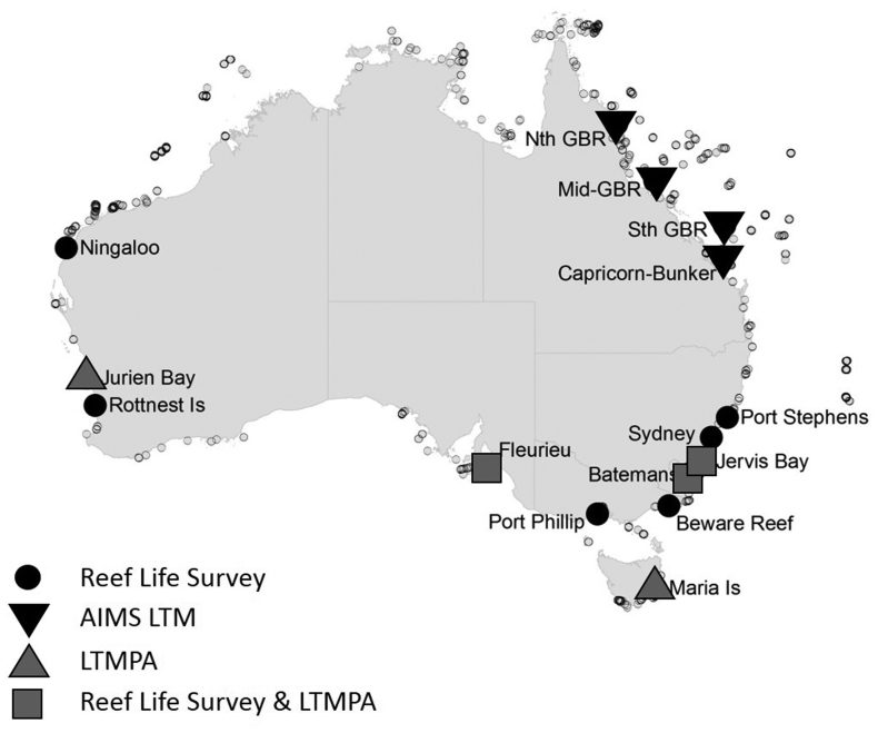
Figure 1.
A map of Reef Life Survey (RLS) sites surveyed from 2010 to 2015 and used in spatial analyses (small symbols, n = 1294), as well as long-term monitoring locations from RLS (n = 357), the Long-Term Temperate Marine Protected Area Monitoring (LTMPA; n = 182 sites) program, and the Australian Institute of Marine Science Long-Term Monitoring (AIMS LTM; n = 276 sites) program used for temporal trend assessment.

