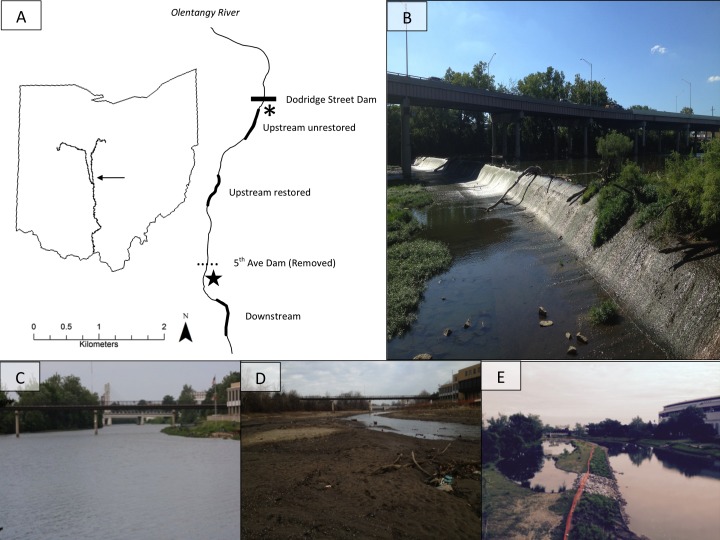
Figure 1. The map (A) shows study site locations on the Olentangy River, and (B) shows the former dam. The remaining photographs depict views upstream of the 5th Avenue Dam overlooking the upstream-restored reach on the Olentangy River, Columbus, Ohio before (C), 2 months (D), and 36 months (E) after dam removal.
Thicker lines in (A) denote the study sites: upstream unrestored, upstream restored, and downstream. The horizontal dotted line indicates the location of the former dam, and the horizontal solid line indicates the location of an intact lowhead dam (Dodridge Street Dam), directly downstream of which is the from Vent (2015). Photo credits: SMP Sullivan.

