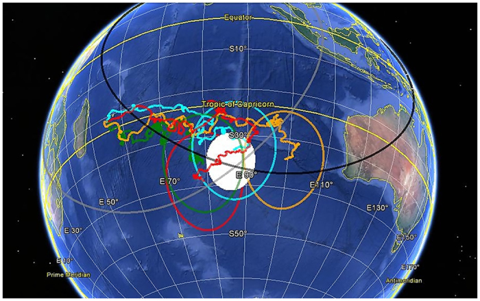
Figure 6. Estimate of MH370 impact area in the Southern Indian Ocean.

The hypothetical impact region is the white shaded circular area centered in −35°S, 86°E. Drifter identification numbers are: 24746 (red), 70854 (orange), 70969 (green) and 83341 (cyan). Localization errors associated to each ending point of the drifters are the circular areas of radius ~103 km of the same color as the corresponding drifters. The gray circle represents the 7th BTO arc measured from Inmarsat of radius ≃ 4750 km centered in 0°, 64.5°E. The black circle represents the maximum flight range from the last known position of MH370 of radius ≃ 4800 km centered in 6°N, 96°E. This map was generated with free online utility GPS Visualizer (http://www.gpsvisualizer.com/) and Google Earth (https://www.google.com/earth/).
