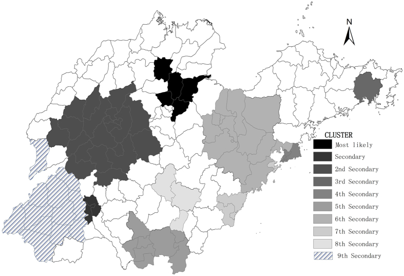
Figure 6. Spatial-temporal clusters of mumps in Shandong Province, China from 2005–2014.
The space-time scan proposed by Kulldorff is integrated in SaTScanTM v9.4 (http://www.satscan.org/) and clusters are depicted on the map using the software ArcGIS10.2 (https://www.arcgis.com/features/index.html, ESRI, Inc., Redlands, CA, USA).

