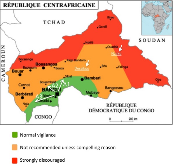
Figure 1.

Map of the CAR, showing the directions chosen for sampling and the security situation in the country; This map was made available to all partners in health by the WHO are indicated the different axes (A1: Axis Bangui-Damara-Mbourouba; A2: Axis Bangui-Boali; A3: Axis Bangui-Mbaïki-Mbata) and Dessikou and Nzako cities that could not be investigated
