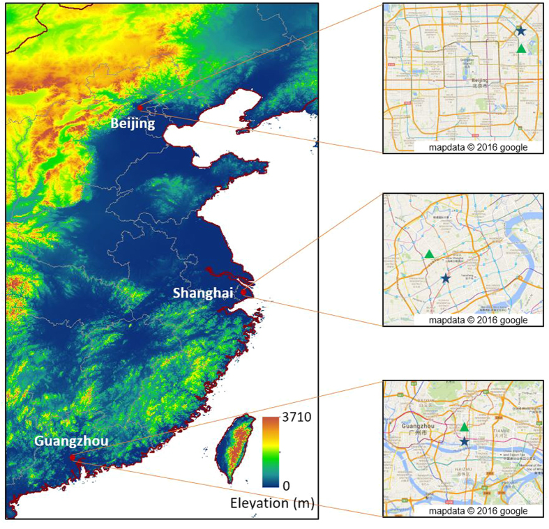
Figure 12. Locations of BJ, SH, and GZ, denoted as red points.
The blue stars in the right panel denotes the locations of US embassy (consulates). The green triangles denote locations of the monitors for gaseous pollutants. The map in the left panel was drawn by ArcGIS (version 10.1, http://www.arcgis.com/) software and the maps in the right panel were obtained from Google maps (map.google.com).

