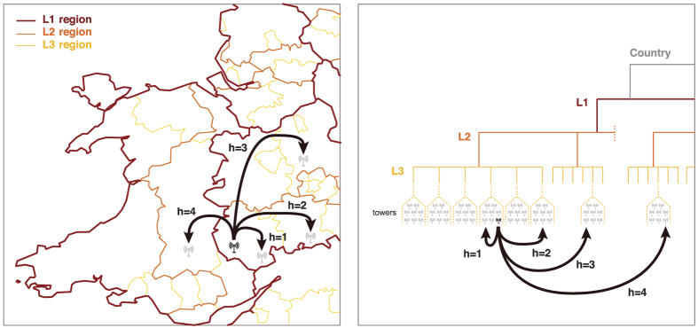
Figure 1. Partitioning of a country based on telephone call networks.
Hierarchical distances between two locations are defined through three regional levels - either administrative ones or those found by applying iterative community detection on human interaction networks. Two distinct locations are at a hierarchical distance h = 1, if they are in the same L3 region, h = 2, if they are in different L3 regions but in the same L2 region, h = 3, if they are in different L2 regions but in the same L1 region and h = 4, if they are in different L1 regions. Note that a higher hierarchical distance does not necessarily correspond to higher geographical distance. The figure has been created using Matlab R2015b (http://www.mathworks.com) and publicly available shapefile data for the regional borders (http://ec.europa.eu/eurostat/web/gisco/geodata/reference-data/administrative-units-statistical-units, (c) EuroGeographics, 2016).

