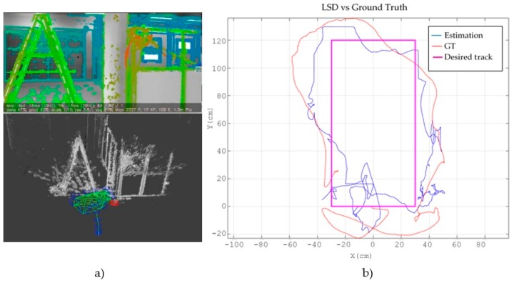
Figure 10.
Results obtained with the minimal sensor configuration using LSD-SLAM. (a) shows the view of the frontal camera with the obtained depth map at the top and the estimated trajectory embedded in the cloud points map below; (b) shows the desired track projected in the XY plane (magenta colour), the ground truth path obtained with the external camera (blue colour) and the path estimated with the SLAM system (red colour).

