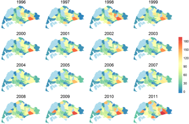
Figure 2.
Estimated case count of TB cases in 44 planning areas of Singapore. Counts were computed by integrating the estimated spatial intensity over the planning area polygons. The plots capture higher risk of cases in Bedok and the surge of cases in Jurong West. Plots were created in statistical program R22 using the package spatstat 19. Administrative and national political coordinates of Singapore were provided, for academic research and publication, by the Singapore Land Authority (SLA)24.

