
Figure 1.
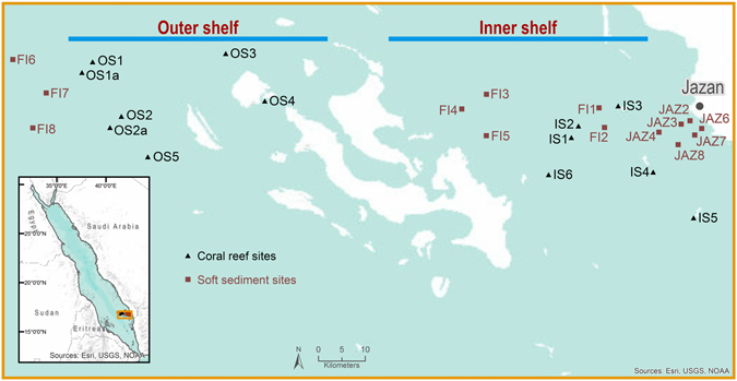
Map showing the location of the reef and soft sediment sites sampled across the Farasan shelf in the southern Red Sea. This figure was created using the ArcGIS software (ArcMap 10.3.1) by ESRI, Inc. (ESRI.com), GEBCO, DeLorme, US Geological Survey (USGS) and the National Oceanic and Atmospheric Administration (NOAA) photo library.