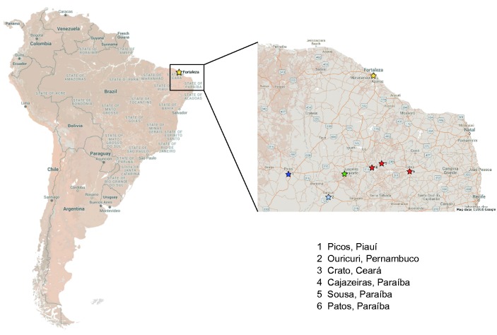
Fig. 1.
Geographical Map of Brazil showing the location of Fortaleza, the capital city of Ceará state, and other study centers. The inset shows the location of study recruitment centers in the North-Eastern region of Brazil. The location of Fortaleza is indicated by the yellow star icon, and other state color-coded locations are: Picos (Piauí—dark blue); Ouricuri (Pernambuco—light blue); Crato (Ceará—green); Cajazeiras, Sousa and Patos (Paraíba—red). For scale, the distance from Fortaleza to Picos (1.) or from Fortaleza to Ouricuri (2.) is approximately 300 miles.

