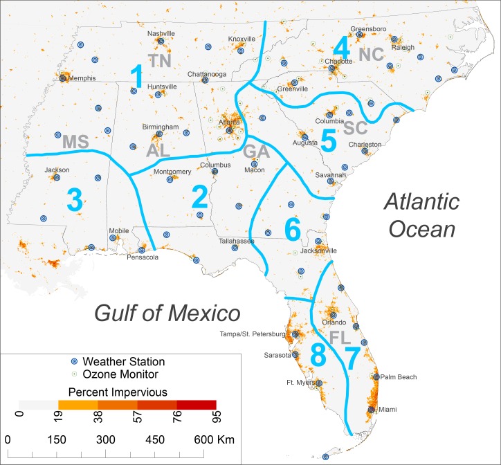
Fig 1. The southeastern United States and the apparent-temperature regions within it.
The 63 weather stations and 63 ozone monitors for which data were obtained are shown in addition to the urbanization of 1-km2 cells based on percent impervious surface. Impervious-surface data, originally at 30-m resolution, were obtained from the Multi-Resolution Land Characteristics consortium.

