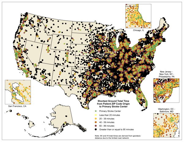
Figure 1.
Map of the United States demonstrating the shortest ground travel time to a Primary Stroke Center (PSC) of Medicare stroke patients, using road network data. Travel times for AK and HI have been calculated based on geodesic distances. Green dots represent PSCs, while all other dots represent ZIP code centroids of various total travel times to the closest PSC.

