
Figure 1.
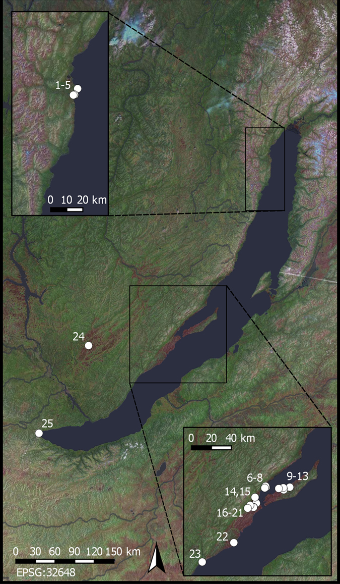
Map of the Lake Baikal region of the Russian Federation: (a) North Baikal; (b) Priol’khon’e. Archaeological sites analyzed in the study indicated: 1) Relka 1; 2) Baikal’skoe 7; 3) Baikal’skoe 27; 4) Baikal’skoe 31; 5) Krasnyi Iar; 6) Kurma 2; 7) Khadarta 2; 8) Tsagan-Nuge 2; 9) Khuzhirtui 1; 10) Elga 21; 11) Elga 7; 12) Khuzhir 2; 13) Khuzhir 4; 14) Khuzhir-Nuge 18; 15) Khuzhir Nuge 3; 16) Olzontei 16; 17) Kargarnai 1; 18) Olzontei 6; 19) Shara-Tagot; 20) Kurkut 4; 21) Olzontei 8; 22) Sagan-Zaba 2; 23) Bugul’deika 2; 24) Mankhai 3; 25) Shamanka 2. Landsat data courtesy of the U.S. Geological Survey. Landsat image tiles, which are open access files, were acquired through QGIS QuickMapServices62.