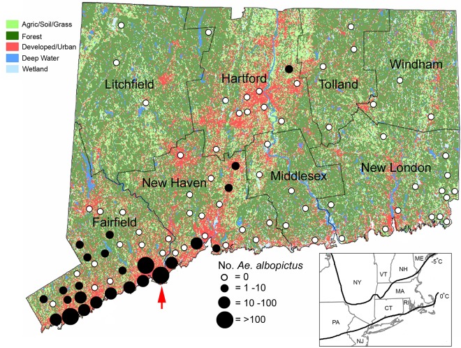
Fig 1. County map of Connecticut showing geographic distribution of mosquito trapping sites and land use characteristics.
Black circles indicate locations where Ae. albopictus were collected from 2006–2016 and are scaled according to numbers collected at each site. Red arrow indicates location of the Stratford site. Inset map of northeastern U.S. shows approximate location of the 0°C and -5°C cold month isotherm.

