
Figure 1.
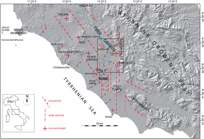
Location map. Digital Elevation Model (DEM) image showing the structural setting of the area on the Tyrrhenian Sea Margin of Latium subjected to continental sedimentation since the late Santernian, and the location of the sites providing biostratigraphic constraints to the Santernian-Emilian sedimentary basins. Modified after TINITALY/01 square WA 6570, used with permission of the Istituto Nazionale di Geofisica e Vulcanologia, Rome.