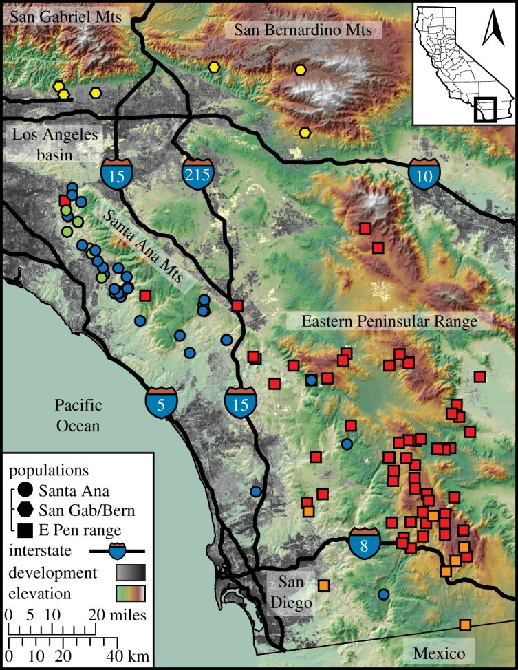
Figure 1.

Pumas sampled (N = 146) in the Los Angeles–San Diego region of California, USA (inset map) were subdivided into three populations separated by major interstate highways (I-15, I-10). Circles, hexagons and squares indicate pumas, respectively, belonging to the Santa Ana, San Gabriel/Bernardino and Eastern Peninsular Range populations identified in GENELAND (figure 2a). Colours correspond to highest subpopulation admixture proportions identified in TESS (figure 2b).
