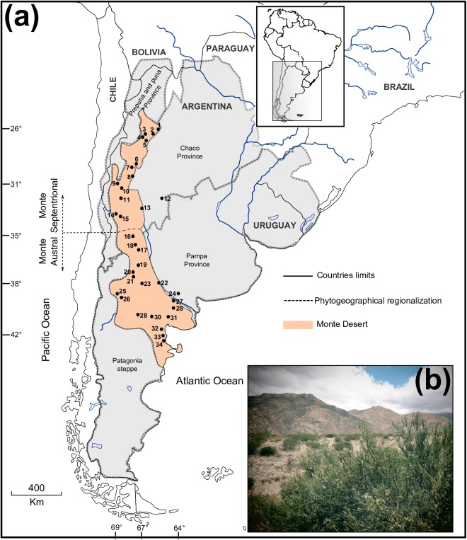
Fig 1. Geographical distribution of the Monte Desert and Monttea aphylla.
(a) Map showing the 34 Monttea aphylla populations included in this study. Inset indicates the study area in South America. Locality numbers correspond to those in S1 Table. The orange area shows the extent of the Monte Desert. Thick dotted lines delimitate the phytogeographical areas. The thin dashed line represents the limit of northern and southern Monte. (b) Overview of the Monte Desert and a plant of Monttea aphylla in the foreground. The map shown in (a) is reprinted from [31] under a CC BY license, with permission from [DIVA-GIS and Dr. Robert Hijmans; see S1 Doc], original copyright [2005].

