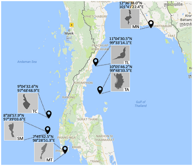
Figure 1.

A map showing the sampling sites (with GPS coordinates) in the Gulf of Thailand and Andaman Sea. Sampling locations are abbreviated as follows: Mannai (MN), Talu (TL), Tao (TA), Tachai (TC), Similan (SM) and Maiton (MT). The main and inset maps were drawn using the R packages83 ‘ggplot2’ version 2.2.1 (https://cran.r-project.org/web/packages/ggplot2/ggplot2.pdf)84 and ‘ggmap’ version 2.6.1 (https://cran.r-project.org/web/packages/ggmap/ggmap.pdf)85. The static map of the Gulf of Thailand and Andaman Sea displayed was queried from the Google Maps (Map data©2016 Google) using the function ‘get_map’ in the ‘ggmap’ package.
