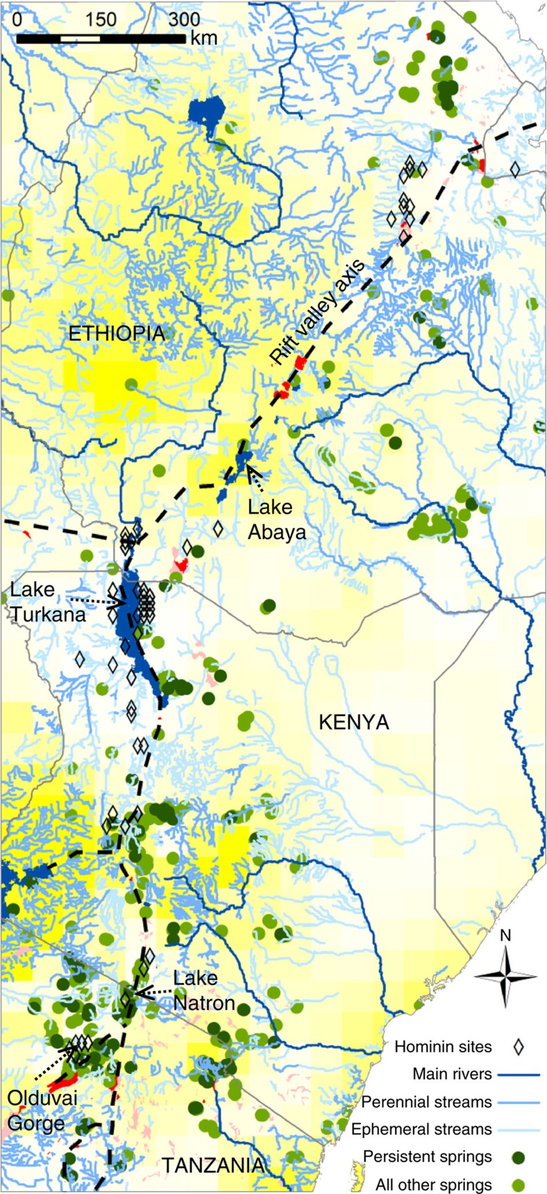
Figure 1. The pattern and mode of hydrologically available water in present day eastern Africa.
The distribution of water is controlled by geology, topography and climate. Hominin sites are closely associated with the rift valley axis. Fresh water lakes (dark blue), alkaline/saline lakes (red), wetlands (pink), background is groundwater recharge from Döll & Fiedler15 coloured yellow (250 mm y−1) to white (0 mm y−1). ‘Persistent Springs' are those modelled as productive (>1,000 m3 y−1) at precessional (23 ky) minima under gradual climate change. The number of such springs is considered conservative, since at least some persistent springs are likely to be present during dry periods in areas currently mapped as having perennial streams. Streams, lakes and marshes digitized from map series as described in the Methods; National borders and main rivers >5 km3 y−1 from ‘Major rivers of the World, classified by mean annual discharge', GRDC http://grdc.bafg.de. Projection: WGS 1984.

