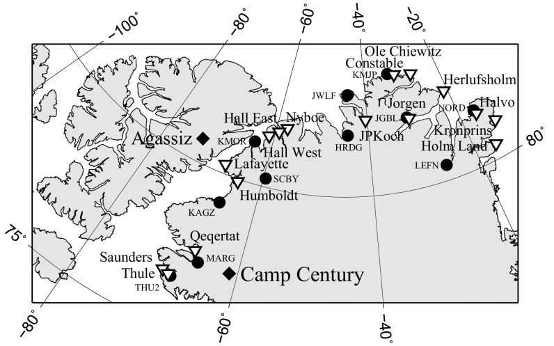
Fig. S6.
Relative sea level and GPS sites: The location of the relative sea level sites shown in Fig. S7 are indicated by downward-facing triangles. The diamonds represent the locations of the Agassiz and Camp Century ice cores. The circles represent the locations of the Greenland GPS Network (GNET) sites in North Greenland listed in Table S1.

