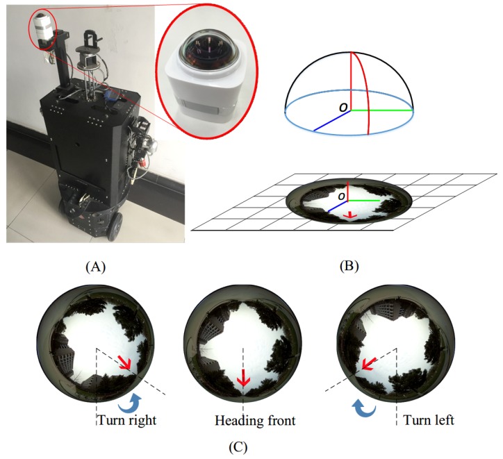
Figure 1.
(A) A spherical camera mounted on a ground robot platform. (B) The spherical camera coordinate systems and its imaging model. Natural scenes are warped into the circular fisheye image. (C) Samples of captured spherical images. Red arrows denote the detected optimal path. Our objective is to generate navigation signals (denoted by blue arrows, i.e., steering direction and angles) based directly on these fisheye panoramas.

