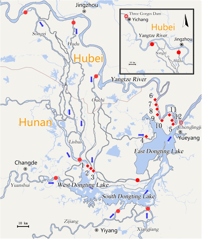
Fig 1. Maps of Three Gorges Dam, Yangtze River and Dongting Lake.
Blue arrows represented flow direction of rivers or lakes; Red dots represented diversion channels of Yangtze River, and four tributaries (Xiang, Zi, Yuan and Li rivers) into Dongting Lake; Red circles represented outlets of Dongting Lake into the Yangtze River; Red diamond and surrounding Arabic numeral represented locations of each monitoring site: 1→Songzi estuary, 2→Ouchi (middle branch) estuary, 3→Ouchi (Tuojiang river) estuary, 4→Ouchi (east branch) estuary, 5→Dongting Lake outlet, 6→Water gate of Hongshuigang, 7→Water gate of Tanzikeng, 8→Water gate of Sizhiqu, 9→Water gate of Liuzhiqu, 10→Water gate of Jingjiangmen, 11→Water gate of Bei, 12→Water gate of Aiwei.

