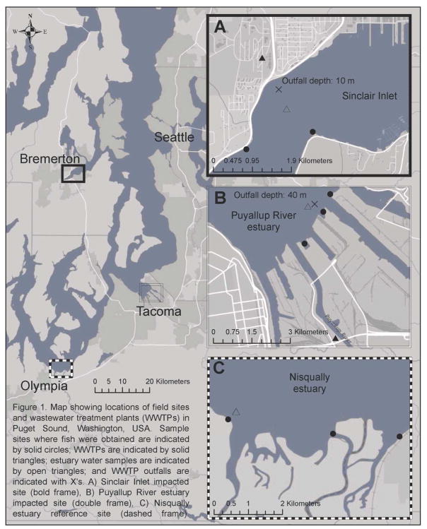
Figure 1.
Map of Puget Sound and estuaries sampled with locations of wastewater treatment plant outfalls and sampling sites.
Map showing locations of field sites and wastewater treatment plants (WWTPs) in Puget Sound, Washington, USA. Sample sites where fish were obtained are indicated by solid circles; WWTPs are indicated by solid triangles; estuary water samples are indicated by open triangles; and WWTP outfalls are indicated with X’s. A) Sinclair Inlet impacted site (bold frame), B) Puyallup River estuary impacted site (double frame), C) Nisqually estuary reference site (dashed frame).

