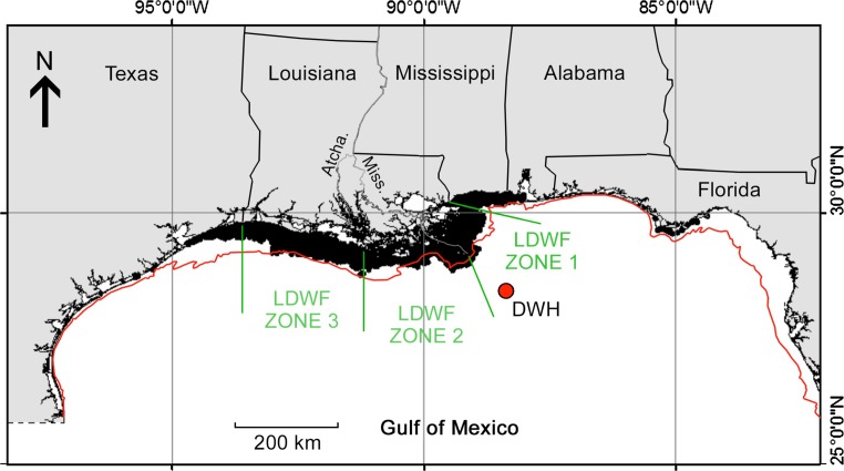
Fig. 1.
Spatial distribution of commercially exploited aggregations of Gulf menhaden in the northern Gulf of Mexico, as indicated by commercial purse seine fishing effort (black shading near shore) during 1986–2011 (from Fig. 5.11 in Schueller et al. 2013). Red dot indicates the location of the Deepwater Horizon wellhead. Louisiana Department of Wildlife and Fisheries (LDWF) trawl index survey zones are indicated in green. The red line indicates the 18-m depth isopleth offshore. Atcha. Atchafalaya River, Miss. Mississippi River

