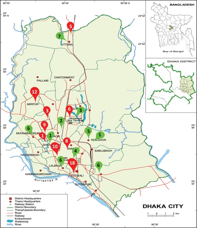
FIG 3.
Sample collection sites in the map of Dhaka city. Inset, location of Dhaka district within map of Bangladesh and location of Dhaka city within Dhaka district. The red pointers indicate the locations adjacent to hospitals (HAR), and the green pointers indicate the locations in community areas (COM). Numbers within pointers denote the number of wastewater samples collected from each area. An equal number of tap water samples was collected from each area. Map template from World Map (http://www.worldmap1.com/map/Dhaka-map).

