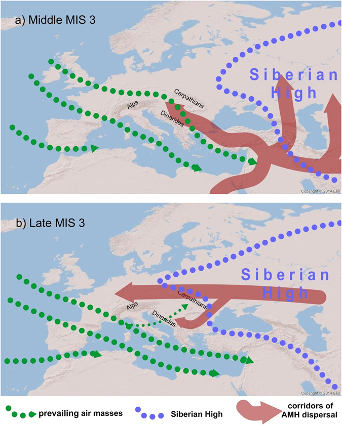
Figure 5.

(a) Simplified scheme of proposed general atmospheric circulation patterns over Europe during middle MIS 3. Note that the Westerlies were reaching Central and Southeastern Europe via the NW-SE trajectory; (b) Simplified scheme of proposed general atmospheric circulation patterns over Europe during late MIS 3. Increase Siberian High influence on Europe had a major influence on Eastern and Western Europe, while the Westerlies shifted to the S-E trajectory, bringing the warmer air masses from the Mediterranean to the Balkans and the Middle Danube Basin. The blue line represents a schematic intensification of Siberian High, green lines show prevailing air masses and red lines represent paths of AMH dispersal in Europe. The map was generated using ArcGIS 10.2.2 (http://www.esri.com/software/arcgis).
