
Figure 1.
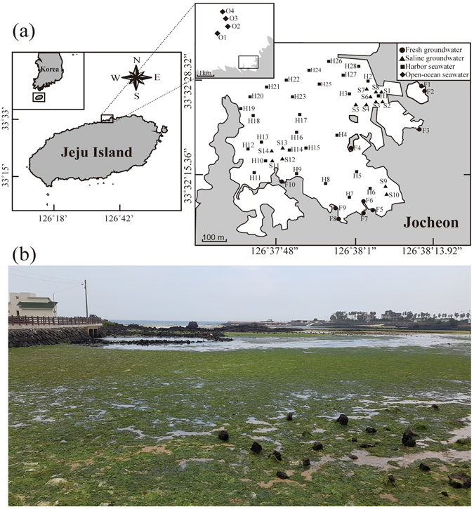
(a) The maps showing the sampling stations in coastal area of Jocheon, Jeju Island. The filled circles, triangles, squares and diamonds represent fresh groundwater (Sts. F1-F10), saline groundwater (Sts. S1-S14), harbor seawater (Sts. H1-H28), and open-ocean seawater (Sts. O1-O4), respectively. Maps were created using Adobe Illustrator CC (http://www.adobe.com/illustrator). (b) Photograph of massive green tide development in Jocheon, Jeju Island.