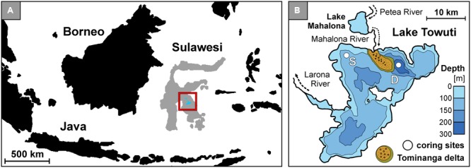
FIGURE 1.

Lake Towuti location, bathymetric map with the Tominanga delta and two drilling sites. (A) Map of the Indonesian archipelago displaying the location of Sulawesi Island and Malili Lake System. (B) Bathymetric map of Lake Towuti (after Russell et al., 2016) with its major tributary and river delta (after Vogel et al., 2015), with locations of the shallow (S: 60 m water depth) and deep (D: 200 m water depth) coring site.
