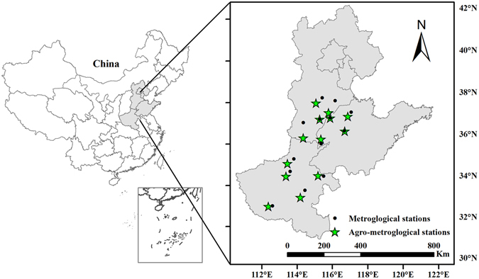
Figure 8.

Locations and spatial distribution of the metrological and agro-meteorological stations on the North China Plain. A map of China showing the locations of the three provinces and municipalities within the country (shaded area). Black dots and green pentagrams represent the meteorological and agro-meteorological stations, respectively. Lines indicate province boundaries. Maps were generated using ArcGIS 10.1 (ESRI Inc, Redlands, CA, USA, http://www.esri.com/).
