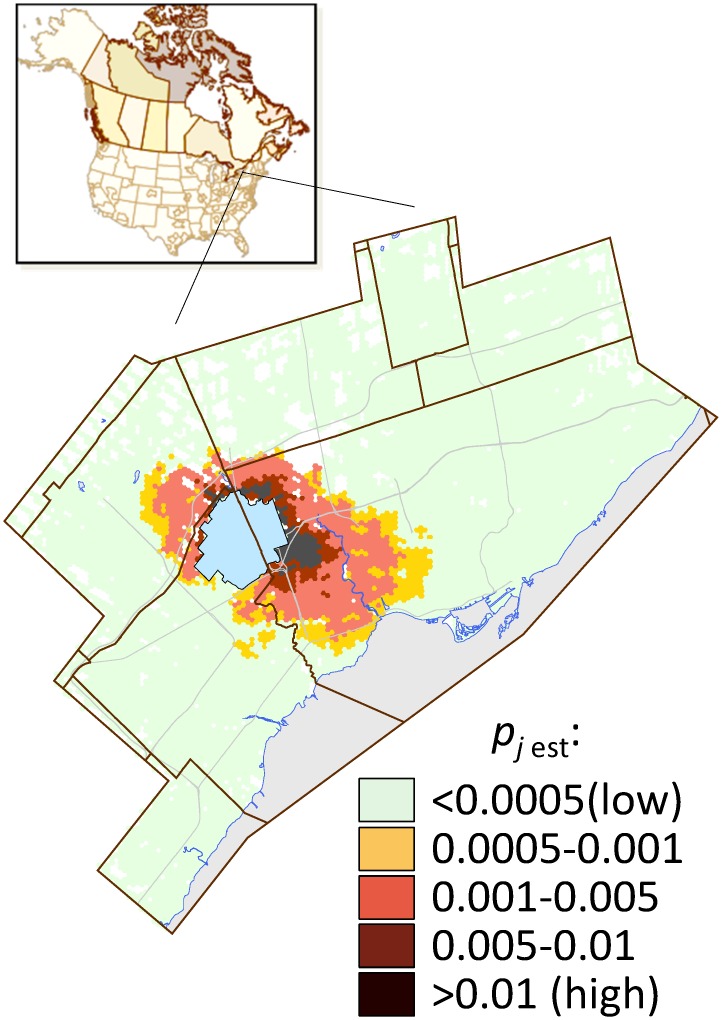
Fig 2. Probability of ALB spread, pj est, in the Greater Toronto Area (GTA).
The blue polygon depicts the initial quarantine area defined when ALB was discovered in Mississauga in 2013. The calculated probability for each map location (i.e., each 400×400-m block) is the mean value from 6000 stochastic spread scenarios.

