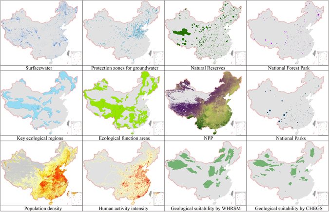
Figure 3.

Dataset for basic environmental elements (Sources: Wuhan Institute of Rock and Soil Mechanics, Chinese Academy of Sciences (WHRSM); China Geological Survey Center for Hydrogeology and Environmental Geology Survey, Baoding, China (CHEGS)). Note: NPP, net primary production. The map in this figure were generated by software ArcGIS 9.2 (http://www.esri.com/arcgis/about-arcgis) based on our own data. The China spatial boundary GIS data is from the National Geomatics Center of China (affiliated with National Administration of Surveying, Mapping and Geoinformation of China), which provides the basic GIS data for China.
