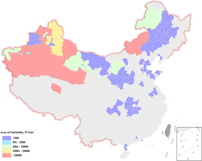
Figure 9.

Mapping of areas classified as environmentally suitable for CO2 capture and storage as class IV in China’s prefecture-level regions. Four categories of suitability for CO2 geological storage include I and II, III and IV with increasing suitability. The map in this figure were generated by software ArcGIS 9.2 (http://www.esri.com/arcgis/about-arcgis) based on our own data. The China spatial boundary GIS data is from the National Geomatics Center of China (affiliated with National Administration of Surveying, Mapping and Geoinformation of China), which provides the basic GIS data for China.
