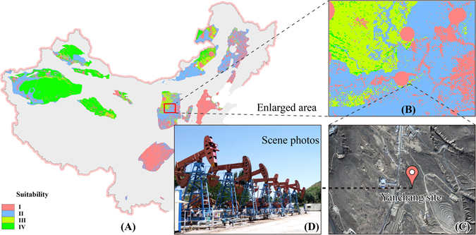
Figure 10.

Environmental suitability of the Yanchang CO2 Capture, Utilization and Storage project. Four categories of suitability for CO2 storage include I and II, III and IV with increasing suitability. (A) Environmental suitability results of China; (B): Enlarged area in (A) of Yanchang site; (C): Remote sensing images of Yanchang site; (D): Scene photo of Yanchang site. The map in this figure were generated by software ArcGIS 9.2 (http://www.esri.com/arcgis/about-arcgis) based on our own data. The China spatial boundary GIS data is from the National Geomatics Center of China (affiliated with National Administration of Surveying, Mapping and Geoinformation of China), which provides the basic GIS data for China. The satellite map in Fig. 10C was obtained from a commercial source image bought under a contract from the Institute of Remote Sensing and Digital Earth, Chinese Academy of Sciences.
