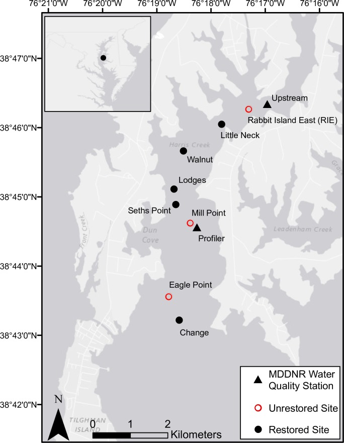
Fig 1. Map of Harris Creek study sites.
Fig 1: Location of Harris Creek Oyster Sanctuary within Chesapeake Bay (inset) and map of study sites within the Harris Creek Oyster Sanctuary, Maryland. Red open circles are control, or unrestored sites. All other sites (black circles) were restored (spat-on-shell added) sites. Maryland DNR water quality monitoring stations are denoted by black triangles (Upstream Station XFG6431, Profiler Station XFG4618).

