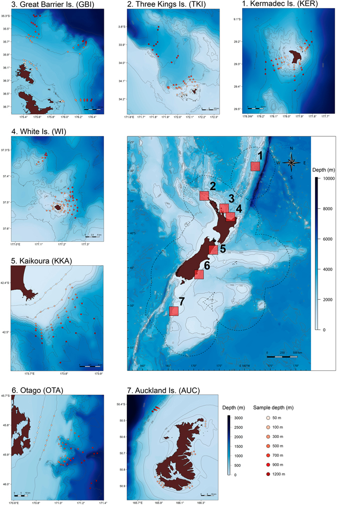
Figure 1.

Latitudinal beta diversity sampling sites. Fishes were sampled at multiple depths (50, 100, 300, 500, 700, 900 and 1200 m) using baited remote underwater stereo-video (stereo-BRUVs) deployments at each of seven locations: Kermadec Islands, Three Kings Islands, Great Barrier Island, White Island, Kaikoura, Otago and the Auckland Islands. Map created using R85. Bathymetry source: Depth contour polyline (Hydro, 1:350 k–1:1,500 k), Land Information New Zealand, Crown Copyright Reserved. Land data source: NZ Coastlines (Topo, 1:50 k), Land Information New Zealand, Crown Copyright Reserved.
