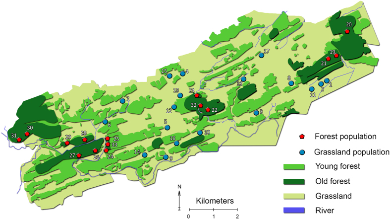
Figure 5.
Map of the study area with forest populations indicated by red pentagons and grassland populations by blue circles. Old forest are forests that were present at least from 1775 until today. Map modified with QGIS (www.qgis.org) from OpenStreetMap.org. OpenStreetMap is made available under the Open Database License: http://opendatacommons.org/licenses/odbl/1.0/. Any rights in individual contents of the database are licensed under the Database Contents License: http://opendatacommons.org/licenses/dbcl/1.0/.

