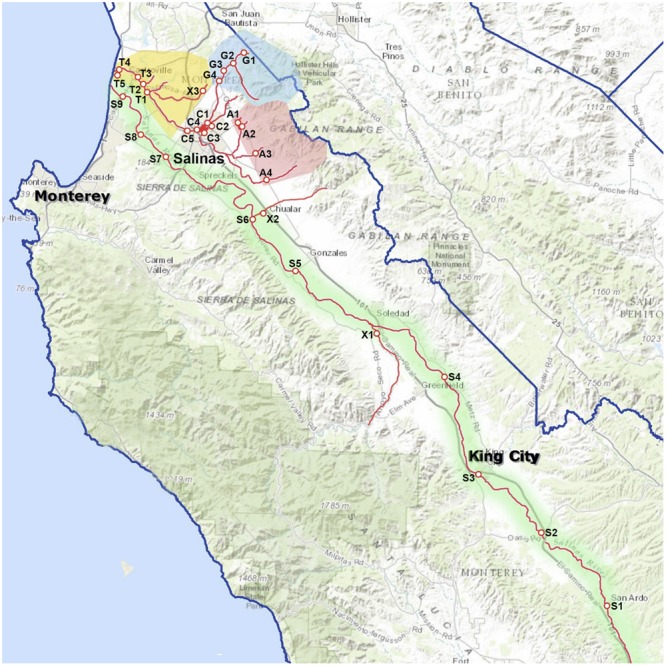
FIGURE 1.

Map of the Salinas Valley, sampling sites, and groupings by region: Tembladero Slough region = sites T1 through T5; Carr Lake region = sites C1 through C5; Gabilan Creek region = sites G1 through G4; Alisal Creek region = sites A1 through A4; Upper Salinas River region = sites S1 through S5; Lower Salinas River region = sites S5 through S9; X = site X1-X3, sampled regularly but do not fit into any of the designated watersheds.
