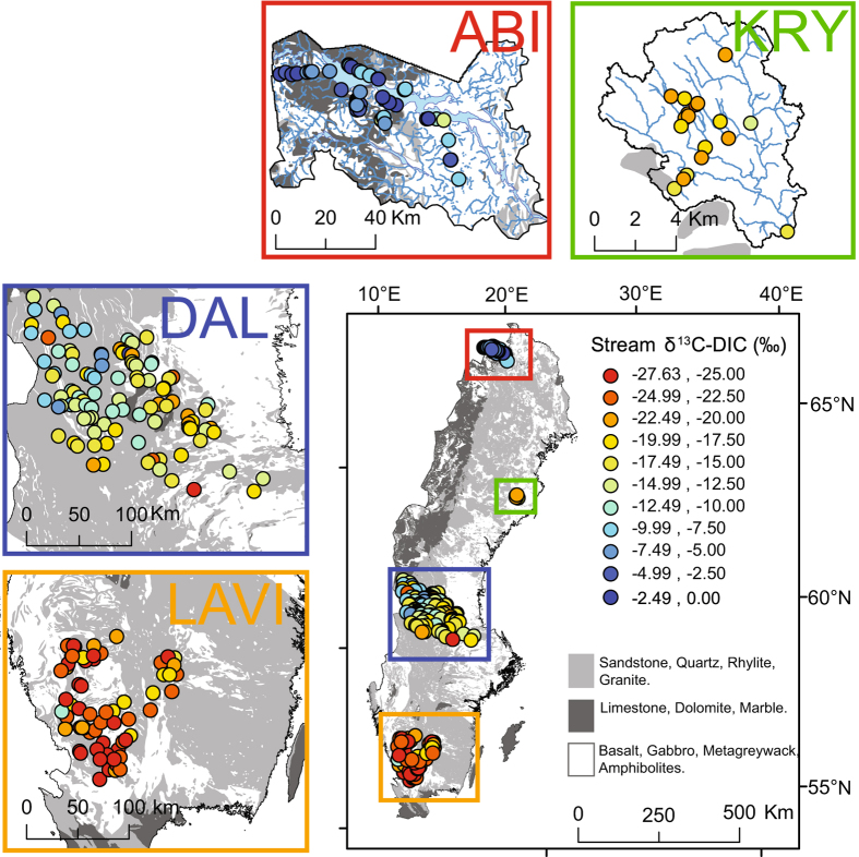
Figure 2.
Map of sampled streams across the different regions included in this study (LAVI, DAL, KRY, ABI). Circles represent individual stream sampling locations and are colour coded according to their δ13C-DIC values, expressed in per mille (‰). Calcium carbonate containing bedrocks (limestone, dolomite and marble), representing a potential geogenic DIC source, are identified in dark grey, while silicate rich rocks (sandstone, quartz, rhyolite and granite) are identified in light grey and rocks that are very resistant to weathering (basalt, gabbro, metagreywacke and amphibolites) are identified in white, The map was generated using ArcMap 10.3.1 (http://www.esri.com/), with the information for the background geological map (bedrock 1:50 000–1:250 000) obtained from © Geological Survey of Sweden (SGU).

