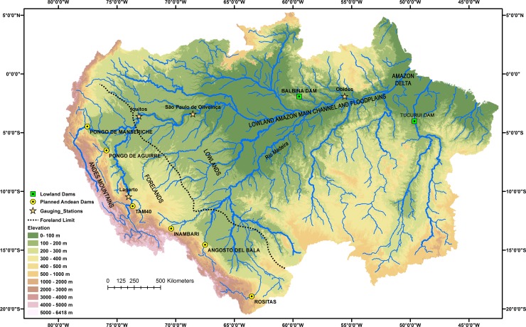
Fig 1. Amazon basin, showing main hydrological and geomorphological features and locations of proposed Andean dams.
Locations of river gauging stations and lowland dams mentioned in the text indicated. Topography derived from the Shuttle Radar Topographic Mission Digital Elevation Model, National Aeronautics and Space Administrations, USA (SRTM-DEM, NASA).

