Figure 1.

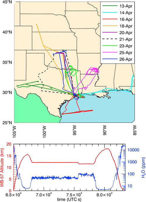
(top) Map of MACPEX flight tracks for all flights included in the comparisons. (bottom) Time series of altitude and WV (DLH) mixing ratios during a typical MACPEX WB-57F flight on 23 April.

(top) Map of MACPEX flight tracks for all flights included in the comparisons. (bottom) Time series of altitude and WV (DLH) mixing ratios during a typical MACPEX WB-57F flight on 23 April.