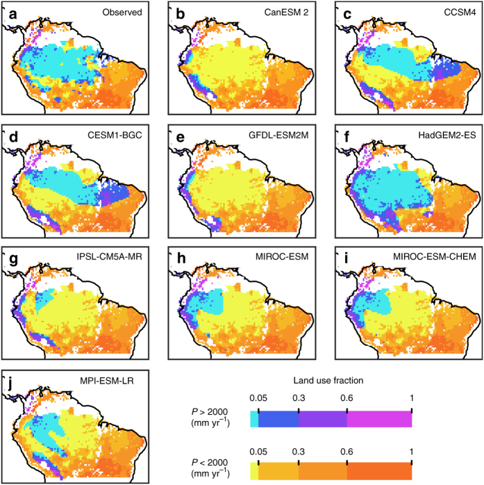
Fig. 5.
Spatial distributions of land use and water-limited and radiation-limited precipitation for 1981–2005. a Observed precipitation (P)56, 57 and land use26. P was divided into water-limited (P < 2000 mm yr−1) and radiation-limited (P > 2000 mm yr−1) categories based on the empirical 2000 mm annual P regime breakpoint. Land use fractions was divided into four classes and used to vary the colours (yellow to red and blue to magenta for water-limited and radiation-limited, respectively). b–j The corresponding P-land use maps for each of the nine Earth system models (ESMs)

