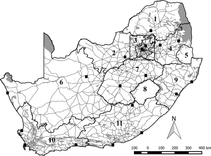
Figure 1.

Study area: (1) Limpopo Province, (2) North West Province, (3) the four degree square comprising the Gauteng 4D birding challenge, (4) Mpumalanga Province, (5) Swaziland, (6) Northern Cape Province, (7) Free State Province, (8) Lesotho, (9) KwaZulu‐Natal Province, (10) Western Cape Province, (11) Eastern Cape Province. Thick lines indicate province and country boundaries, and fine lines indicate major roads. Black squares indicate the location of sampling hubs, that is, locations with exceptionally high sampling effort. Gray shading indicates all terrestrial formal and informal protected area (SANBI, 2010, 2011)
