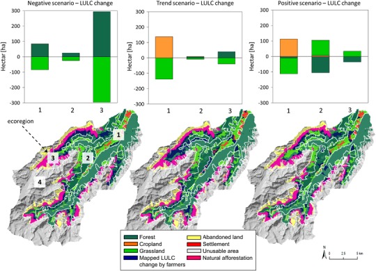
Fig. 3.

Changes in LULC (current—2050) within the ecoregions (1) valley, (2) forest belt, and (3) sub-alpine zone for the trend, positive and negative scenarios (no changes were recorded for the (4) alpine/nival belt). Within the diagrams abandonment of grassland results directly in forest (transition state “abandoned land” skipped over). Maps of the Stubai Valley show location of LULC changes mapped by farmers for each scenario. Natural afforestation (mapped in pink) results from grassland already abandoned today
