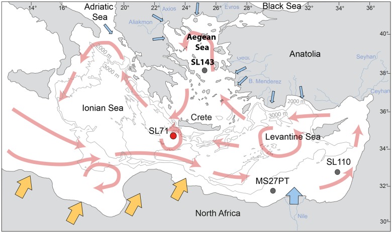
Fig 1. Map of the Eastern Mediterranean Sea with the location of the investigated sediment core M40/4_SL71 investigated in this study, redrafted after [1].
The general surface circulation pattern in the Eastern Mediterranean Sea is marked in red, after [2, 3]. The 2000 m and 3000 m isobaths are included in light grey. Blue arrows indicate the input of riverine sediment, orange arrows indicate the input of Saharan dust. The positions of the sediment cores that are mentioned in the text, M51/3_SL143, M51/3_SL110, are also indicated.

