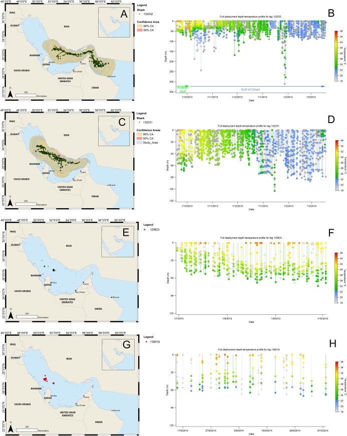
Fig 9.
Estimated satellite tag locations produced from light level analysis throughout deployment of MiniPATs 132232 (A) & 132231 (B) including 95 and 50% location confidence areas and depth. Argos locations throughout deployment of MK10F 129823 (E) & 138516 (G). Deployment time-series depth-temperature data for MiniPATs 132232 (B) & 132231 (D) and MK10F 129823 (F) & 138516 (H). Grey spots represent where temperature data were unavailable.

