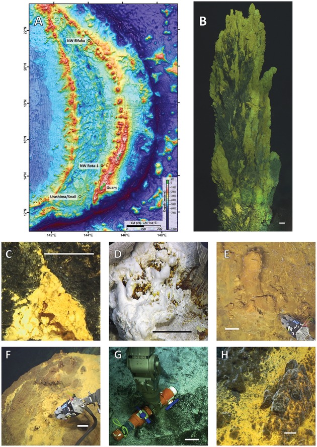
Figure 1.

(A) Bathymetric map of the Mariana region with black circles designating dive locations. Representative photos of mat collection sites: (B) Golden Horn chimney at Urashima; (C) Marker 104 at Snail Vents; (D) Champagne Vents; (E) Yellow Cone Mkr 146, and (F) Yellow Cone Marker 124 at NW Eifuku; (G) Iceberg and (H) Olde Iron Slides at NW Rota-1. Images (F,G) include the biomat syringe sampler and an RNAlater Scoop (LSc), respectively. Scale bars represent 10 cm. Map is courtesy of Susan Merle, NOAA EOI/OSU.
