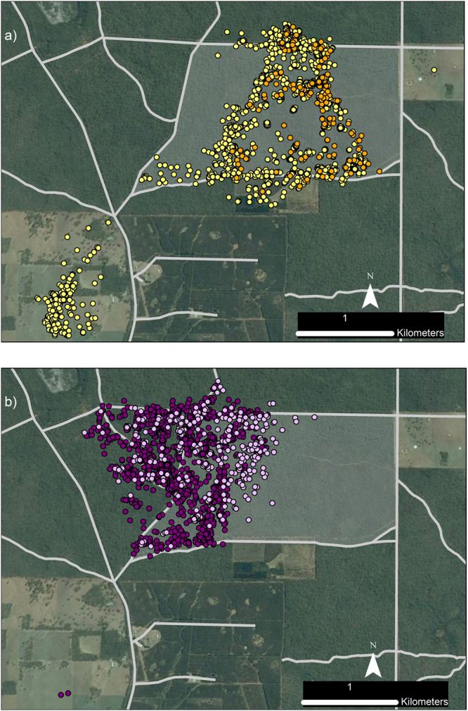
Figure 3.

GPS location data of two adult female foxes Vulpes vulpes a) Fox 6410, b) Fox 4190, before and after a prescribed fire, Annya, Australia. In (a), yellow dots indicate pre-fire locations, orange dots indicate during and post-fire locations. In (b), dark purple dots indicate pre-fire locations, mauve dots indicate during and post-fire locations. Grey shading indicates the burn block; pale grey lines mark roads. Data were collected at 60 min intervals from 15-Jan-2015 and until 25-Apr or 4-May-2015, respectively. The prescribed fire was conducted 13–14 April 2015. Pre-fire, Fox 6410 consistently travelled to open farmland every two to three nights. Her last farmland visit was 9–10 April (three days before fire); she did not leave the forest again during the tracking period. Maps were generated in ArcMap 10.265 using spatial layers listed in Supplementary Table S6. Aerial imagery courtesy Victorian State Government, Australia.
