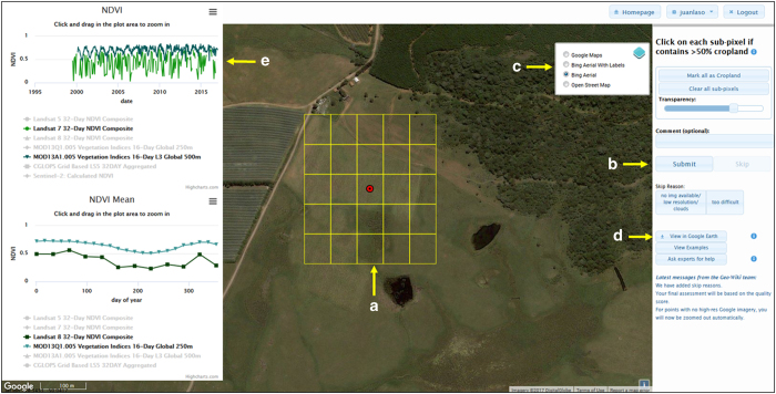
Figure 2. The Geo-Wiki interface (http://www.geo-wiki.org) for collecting cropland information based on image interpretation.
(a) is the sub-grid of pixels that users must classify; (b) is the Submit button that users must press once they have completed their interpretation; (c) allows the user to change the background imagery; (d) shows the ‘View in Google Earth’ button, which users can press to be shown the location in Google Earth so that that they can view historical imagery; and (e) shows the NDVI profiles that can be viewed when the user clicks on a location.

